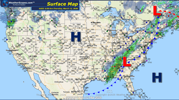
This Morning, the snowstorm that impacted much of the Mid-Atlantic and Northeast is beginning to taper off. While snowfall rates are decreasing, accumulation reports are now slowly coming in and they are impressive. From Delaware through New Jersey, into New York and up along the New England coastline, many communities have measured close to a... Continue Reading →
Weekly Highlights February 22nd to 28th
A dynamic and impactful winter pattern is unfolding across the United States this week, highlighted by a major snowstorm expected to affect the Northeast late Sunday into Monday. A huge snowstorm in the Northeast Sunday/Monday from Baltimore and Washington, D.C. northward through New York City and Boston will bring the potential for over a foot of snow, along with blizzard conditions in some... Continue Reading →
Daily Maps Saturday February 21st, 2026
This morning, we are seeing scattered showers and thunderstorms moving through the Southeast, with the potential for some of these storms to become severe and produce gusty conditions. We could also see some localized flooding from these storms throughout the area and into the Mid-Atlantic states. Farther north, snow is falling across the Great Lakes... Continue Reading →
Daily Maps Thursday February 19th, 2026
This morning, we are seeing some rain showers in the Midwest and into the Mid-Atlantic States. Out West, California continues to contend with ongoing rain and flooding concerns, with additional snowfall expected in the higher elevations of the Sierra Nevada and The Rockies, adding to an already substantial seasonal snowpack. Later today attention turns to... Continue Reading →
