Daily Maps Wednesday April 2nd, 2025

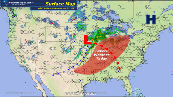
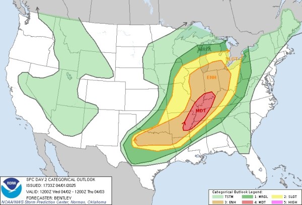
A busy weather day today. Storms have already developed in the Plains overnight and currently. They produced a few tornadoes in Kansas. Those storms will continue in the Midwest down into the Mississippi and Ohio Valley today. Severe weather and tornadoes will be prevalent today. Gusty winds, hail, and heavy rain will also be associated... Continue Reading →

Severe Weather Wednesday April 2nd, 2025

Tomorrow looks to be quite the severe weather event. The SPC has highlighted a large area of the Mississippi Valley into the Ohio Valley as a place where severe weather will be prevalent. As you look at the HRRR resolution radar images you can see how massive these storms will be. The updraft helicity (measures... Continue Reading →

Daily Maps Tuesday April 1st, 2025

Snow in the Northern Plains today with accumulations of 1-4'' with some areas seeing over 4'' along the ND and SD border. Later today some storms will develop in the Central Plains and produce some severe storms. Wind, hail, and tornadoes will be the impacts from these storms. Cooler temps in the Plains, Great Lakes,... Continue Reading →

Daily Maps Monday March 31st, 2025

Today more severe weather will break out in the Southeast and impact the Mid-Atlantic states today. These storms will bring hail and gusty storms. A tornado is not out of the question. Storms will also impact parts of the Northeast today from, Philadelphia to NYC up into Rhode Island. Almost an 1'' of rain is... Continue Reading →

Website Powered by WordPress.com.

Up ↑