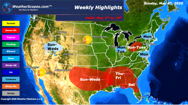
Weekly Highlights May 4th to 10th

This week we are still in an omega blocking pattern that resembles the Greek letter, where two closed off lows separate from the jet-stream. Two low-pressure troughs of cool unsettled weather upstream (West) and downstream (East) and warm dry air in the middle (The Plains). We will be dealing with this pattern until mid-week, where the East and West will see... Continue Reading →

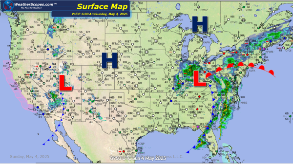
Daily Maps Sunday May 4th, 2025

Today we are still dealing with an omega blocking pattern where two low-pressure systems are closed off from the jet-stream, which brings cool unsettled weather to the West and East. With this pattern the East will see daily chances for showers and thunderstorms until mid-week. Texas will see some chances of severe weather over the... Continue Reading →

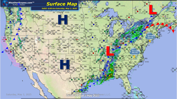
Daily Maps Saturday May 3rd, 2025

Rain and some thunderstorms already developing today for parts of the Ohio Valley down into the Southeast. The East will see some wet conditions today as well as a chance for severe weather across the Northeast and Mid-Atlantic states. With these storms damaging winds and hail will be what to watch out for. localized flooding... Continue Reading →

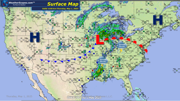
Daily Maps Thursday May 1st, 2025

Some rain and thunderstorms making their way out of the Midwest and into the Northern Great Lakes this morning. More storms will develop later today across parts of the Northeast and stretch down into Texas and Louisiana. Damaging winds and hail will be in play with these storms. Localized flooding will also be a concern... Continue Reading →

Website Powered by WordPress.com.

Up ↑