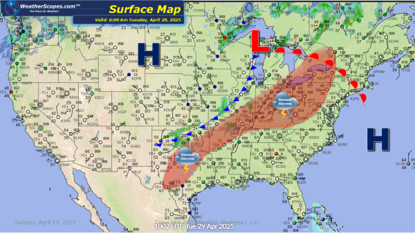
Overall a pretty nice day across the US. Some snow showers across parts of the Northeast today. Accumulations look to be a coating to 2'', with higher elevations seeing more snow. Cooler weather still impacting parts of the Northeast with temps struggling to reach 50 degrees. Warm temps out across the Plains into Texas today.
Daily Maps Tuesday April 15th, 2025
Today rain and some snow showers will make their way through the Great Lakes into the Northeast. Snow in the UP of Michigan and will move into parts of NY and PA later tonight and into tomorrow. Accumulations will be light at around 1''. Rest of the US looking good and warm. The Great Lakes... Continue Reading →
Daily Maps Monday April 14th, 2025
Severe weather will break out in parts of Kentucky into the Baltimore area. With these storm hail and wind damage will be the impacts. The dew points will not be high enough to produce any tornadoes. Snow in the Upper Great Lakes today. Accumulations look to be around 1-4''. Behind the snow some cooler air... Continue Reading →
Weekly Highlights April 13th to 19th
This week we continue to be in a pattern of warm in the West and cool/wet in the East. Monday, some severe weather returns in the Ohio and Tennessee Valley’s, as storms will produce some hail and gusty conditions. The dew points won't be high enough to produce any tornadoes. Also on Monday, portions of the Upper Great... Continue Reading →
