Daily Maps Tuesday February 4th, 2025

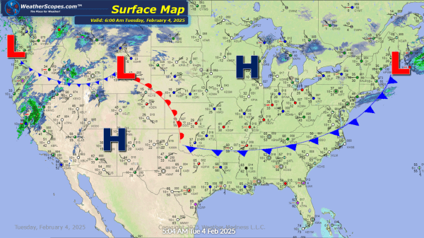
Some light snow falling over the Upper Great Lakes and into the Northeast. Accumulations look to be around a coating to a 1''. The Pacific NW still dealing with snow and rain. Northern California has seen several inches of rain over the past few days, and the potential for localized flooding is still going on.... Continue Reading →

Daily Maps Monday February 3rd, 2025

From the West to East a busy start to the work week. Rain and snow in the Pacific NW. Idaho, Oregon and Montana seeing snow today with accumulations of 1-4'' with higher amounts the higher in elevation. Snow in the Northern Plains with accumulations of a coating to 4''. A clipper coming through parts of... Continue Reading →

Weekly Highlights February 2nd to 8th

This week looks to be a messy one for many of us north of I-80. Multiple days this week we will deal with snow and clippers coming through the area bringing snow and ice. Sunday into Monday, a clipper will come through the Upper Great Lakes and into the Northeast. Then on Wednesday night into Thursday,... Continue Reading →

Daily Maps Sunday February 2nd, 2025

A clipper coming into the Upper Great Lakes into the Northeast today. Accumulations look to be around a coating to 3''. Another clipper will come through the area tomorrow morning and bring 4-6'' in the Upper Great Lakes, and the northern part of Maine. Some of the interior areas of the Northeast could see a... Continue Reading →

Website Powered by WordPress.com.

Up ↑