Daily Maps Sunday January 17th, 2026

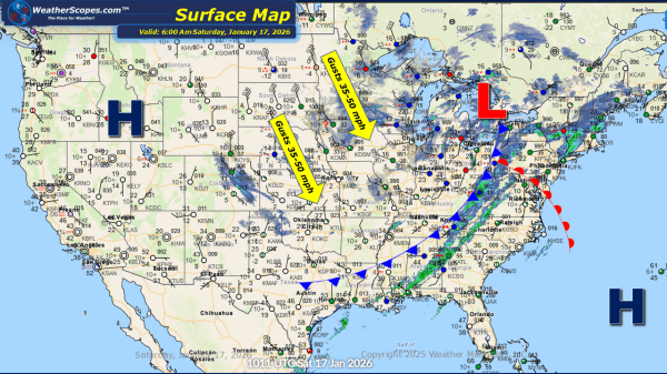
This morning, we are seeing some snow showers across the Great Lakes into parts of the Midwest. Accumulations look to be light with a coating to 2''. The UP and western portions of Michigan could see some higher amounts with 4''+ possible. Rain in the Southeast out ahead of a cold front that will impact... Continue Reading →

Daily Maps Thursday January 15th, 2026

This morning, we are seeing snow come through the Great Lakes, Northeast, and into the Appalachians. This system will continue to make its way to the east throughout the day. Accumulations look to be a coating to 4'', with areas further interior in the Northeast seeing 4''+. Later tonight another system will come through the... Continue Reading →

Daily Maps Wednesday January 14th, 2026

This morning, we are already seeing snow come through the Great Lakes. Lake-effect snow will impact areas along Lake Michigan today bringing some blustery conditions. Gusty winds along Lake Michigan will bring gusts over 30mph. Areas along the western portion of the lake look to see a coating to 1'' while NW Indiana, the UP... Continue Reading →

Daily Maps Tuesday January 13th, 2026

This morning, we are seeing some rain showers across the Great Lakes, where some of that rain could turn to snow for portions of the Great Lakes. Accumulations will be light with a coating possible, as it moves towards the Northeast later today. Not as cold today across much of the central and eastern portions... Continue Reading →

Website Powered by WordPress.com.

Up ↑