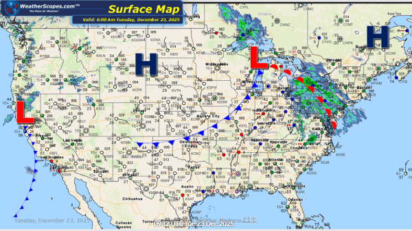
This morning, we are seeing snow and rain in the Northeast. Snow looks to be in NY and Central PA, and some mixed precipitation in Philadelphia and rain further south in DC. Some light accumulations with this system 1-4''. Upstate NY and the NE Pennsylvania/ NY border could see 4'' + from this system. Southern... Continue Reading →
Daily Maps Monday December 22nd, 2025
This morning, we are already seeing some snow showers across the Upper Great Lakes as this system will continue to make its way across The Great Lakes and into the Northeast today and into tomorrow. Accumulations look to be around 1'' and totals will be greater in the Northeast over the next 24-48 hours, with... Continue Reading →
Weekly Highlights December 21st to 27th
This week the weather will remain active across several regions of the country. The Pacific Northwest and Northern California are expected to see additional rounds of showers and thunderstorms, maintaining an elevated risk for flooding in these areas. Residents should continue to monitor local conditions, especially where heavy rainfall has already occurred. By mid-week, Southern... Continue Reading →
Daily Maps Sunday December 21st, 2025
This morning, we are already seeing showers across Northern California into the Pac NW, as rain continues to blanket the area. Today Northern California could see some heavy rains, as localized flooding is still an ongoing issue in the area. In the Northeast some snow showers will come through the area bringing a coating to... Continue Reading →
