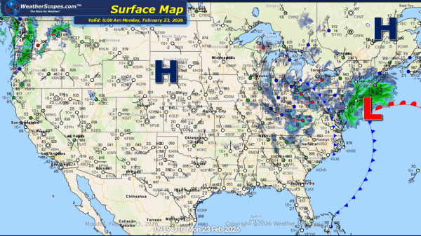
Daily Maps Sunday December 7th, 2025

A fast-moving Clipper swept across the Plains and Great Lakes overnight and into the early morning hours, dropping a quick 2–4 inches of snow for many locations. This system continues to move into the Northeast later today before exiting by tonight. While accumulations there will be lighter, slick travel is still possible during the afternoon... Continue Reading →

Weekly Highlights December 7th to 13th

This week’s weather will be shaped by a steady parade of clipper systems dropping out of Canada and sweeping through the Plains, Midwest, Great Lakes, and eventually the Northeast. The first clipper arrives Sunday, spreading snow across the Plains and into the Great Lakes to start the week. This sets the pattern going forward, with... Continue Reading →

Daily Maps Saturday December 6th, 2025

Today’s weather brings a mix of conditions across the country, with showers expected across the Southeast while the Rockies continue to see snow in the higher elevations. This morning through today and into tomorrow, a quick-moving clipper system will sweep through the Plains and into the Great Lakes, and Northeast bringing 1–4 inches of accumulating... Continue Reading →

Daily Maps Thursday December 4th, 2025

Today showers and thunderstorms will go through areas in Texas and move to the east into the Southeast. These storms don't look to be severe. Some lake effect snow will move through the Great Lakes into the Northeast, with accumulations of a dusting to 2''. New Mexico into the Southern portions of Oklahoma and the... Continue Reading →

Website Powered by WordPress.com.

Up ↑