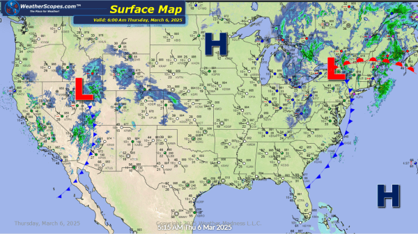
Some leftover snow in the Great Lakes and Cleveland area. Accumulations look to be around a coating to a 1''. Some snow in the Rockies today. Later tonight a clipper will come through the Plains and into the Midwest. Heavier accumulations will be out in the Plains and NW Iowa, while the Midwest will see... Continue Reading →
Daily Maps Wednesday March 5th, 2025
Still dealing with this system over the Midwest and Great Lakes. Snow causing some blizzard like conditions in MN, IA, Wi, with gusty winds and heavy snowfall at times. Accumulations look to be around 1-4'' with an area across Wi, MN, IA seeing 4''+. As this system moves to the east, the rain out ahead... Continue Reading →
Daily Maps Tuesday March 4th, 2025
A robust weather day today. We have rain and thunderstorms in the Mississippi Valley that will produce some severe weather and some tornadoes, especially in the Louisiana area. Those storms will continue to the east today and tomorrow affecting the Tennessee Valley and Mid-Atlantic states. In the Plains we have snow that will produce around... Continue Reading →
Daily Maps Monday March 3rd, 2025
Another mild day in the South and in the Plains. Cooler temps across the Great Lakes and Northeast today. Some light snow in parts of the Great Lakes and Syracuse area with accumulations of a coating. Some thunderstorms will develop late tonight in the Oklahoma/Texas area setting up the stage tomorrow for some significant severe... Continue Reading →
