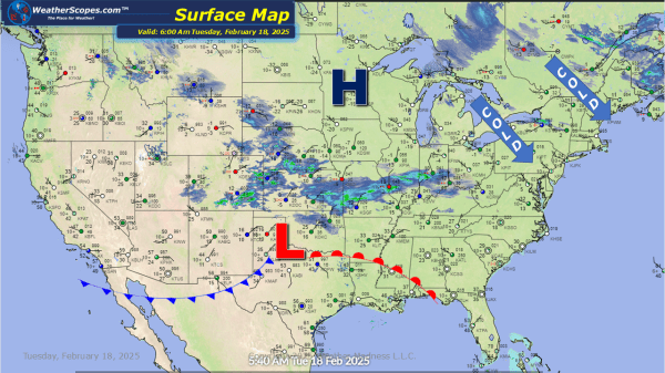
Dangerous cold right now through the Plains into the Great Lakes and Northeast, with temps and wind chills below zero. Our snowstorm making its way through the Plains, Oklahoma, and into the southern parts of Illinois and Indiana. The KC / Topeka area, along with the northern part of Arkansas, should see the highest snowfall... Continue Reading →
Daily Maps Monday February 17th, 2025
Some lake effect snow through the Great Lakes and parts of the Northeast. A coating to 4'' of accumulating snow for the Great Lakes and areas of upstate NY to Maine. The Syracuse area could see 6''+ today into tomorrow. Snow making its way across the Plains with accumulations of 1-4''. Arctic cold coming down... Continue Reading →
Weekly Highlights February 16th to 22nd
This week to start the Northeast will see some significant snow. Areas of NY to Vermont, New Hampshire, and Maine could see snow totals over 12’’ on Sunday, while areas south will see 1-4’’. On the backend areas of the Great Lakes will seesone snow as well. Accumulations 1-4’’. Along with the snow the Northeast will also deal with some ice and mixed precip associated with the... Continue Reading →
Daily Maps Sunday February 16th, 2025
For much of the Northeast and Great Lakes today snow, ice, and wind will bring a blustery start to the week. Ice this morning through parts of central PA to the Boston area. The further interior areas of the NE especially, upstate NY, Vermont, NH, and Maine will see blizzard like conditions and over 12''... Continue Reading →
