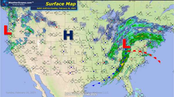
For much of the Northeast and Great Lakes today snow, ice, and wind will bring a blustery start to the week. Ice this morning through parts of central PA to the Boston area. The further interior areas of the NE especially, upstate NY, Vermont, NH, and Maine will see blizzard like conditions and over 12''... Continue Reading →
Daily Maps Saturday February 15th, 2025
Snow continuing today in the Midwest, Great Lakes and into the Northeast. Accumulations look to be a coating to 4''. Higher amounts in the Northeast, Michigan, and parts of Nebraska. Along with the snow moving through, some mixed precipitation and ice will accompany it in areas of the Ohio Valley. Later today some strong storms... Continue Reading →
Daily Maps Thursday February 13th, 2025
Snow continues in the Northeast today from the storm yesterday. Parts of update NY, Vermont, NH, and Maine could see snow accumulations of 8''+. Areas south could see a coating of snow and some rain as well. The Boston area could see some freezing rain. Some lake effect snow in the Great Lakes with some... Continue Reading →
Daily Maps Wednesday February 12th, 2025
Our second snowstorm of the week is making its way through the Plains and Midwest. It will continue to move to the east and impact the Great Lakes and Northeast. Heaviest accumulations look to be 4-8'' for portions of Kansas to the Great Lakes and into the Northeast, and some areas of the interior areas... Continue Reading →
