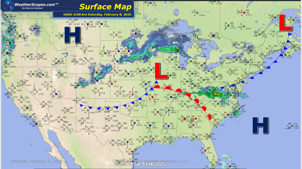
Another day, another storm dropping snow in the Upper Great Lakes. That system will make its way towards the Northeast later tonight and into Sunday. Accumulations for the Great Lakes look to be 4-6'' to the north and further south will see a coating to 3''. That system will produce similar accumulations in the Northeast.... Continue Reading →
Daily Maps Friday February 7th, 2025
Some snow over the Upper Great Lakes parts of the Northeast today. Accumulations look to be around a coating to 3''. Snow also over Montana moving towards the Plains later today and will set the stage for a weekend storm for the Great Lakes. Accumulations in the Northern Plains look to be a coating to... Continue Reading →
Daily Maps Thursday February 6th, 2025
Today, the system that went through parts of the Midwest producing some freezing rain, will continue into the Northeast. This system will bring ice and sleet then turn into snow from NY to Maine. Snow accumulations look to be a dusting to 4'' while the ice accumulation is enough to make driving and walking on... Continue Reading →
Daily Maps Wednesday February 5th, 2025
A system coming into the Upper Great Lakes that will produce a moderate amount of snow 4-6'' to the northern areas and around 2-5'' for the rest of the Great Lakes. Along with that system another one to the south will roll into parts of Iowa and Illinois through the Ohio Valley and into parts... Continue Reading →
