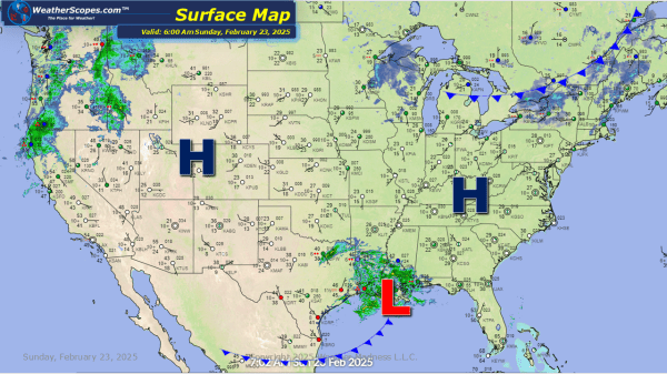
Some lingering snow in the Northeast from the system that came through yesterday, and some light accumulating snow throughout the Great Lakes. The Great Lakes will see a dusting today while this week could bring some significant snow. Accumulations today for the Northeast look to be a coating and around 3-6'' total for the Boston... Continue Reading →
Daily Maps Saturday February 8th, 2025
Another day, another storm dropping snow in the Upper Great Lakes. That system will make its way towards the Northeast later tonight and into Sunday. Accumulations for the Great Lakes look to be 4-6'' to the north and further south will see a coating to 3''. That system will produce similar accumulations in the Northeast.... Continue Reading →
Daily Maps Friday February 7th, 2025
Some snow over the Upper Great Lakes parts of the Northeast today. Accumulations look to be around a coating to 3''. Snow also over Montana moving towards the Plains later today and will set the stage for a weekend storm for the Great Lakes. Accumulations in the Northern Plains look to be a coating to... Continue Reading →
Daily Maps Thursday February 6th, 2025
Today, the system that went through parts of the Midwest producing some freezing rain, will continue into the Northeast. This system will bring ice and sleet then turn into snow from NY to Maine. Snow accumulations look to be a dusting to 4'' while the ice accumulation is enough to make driving and walking on... Continue Reading →
