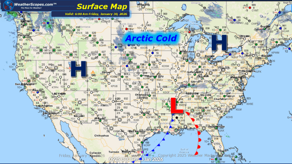
Daily Maps Wednesday January 14th, 2026

This morning, we are already seeing snow come through the Great Lakes. Lake-effect snow will impact areas along Lake Michigan today bringing some blustery conditions. Gusty winds along Lake Michigan will bring gusts over 30mph. Areas along the western portion of the lake look to see a coating to 1'' while NW Indiana, the UP... Continue Reading →

Daily Maps Tuesday January 13th, 2026

This morning, we are seeing some rain showers across the Great Lakes, where some of that rain could turn to snow for portions of the Great Lakes. Accumulations will be light with a coating possible, as it moves towards the Northeast later today. Not as cold today across much of the central and eastern portions... Continue Reading →

Daily Maps Monday January 12th, 2026

This morning, we are seeing some showers out in the Pacific NW, and a clipper coming through Canada that will bring some snow to the interior portions of the Northeast later today. Accumulations look to be around a coating to 3''. Colder weather settling in the eastern portion of the US, as not much will... Continue Reading →

Weekly Highlights January 11th to 17th

This week’s weather pattern remains active across much of the country, with winter firmly holding on in several regions. A series of fast-moving clipper systems will track through the Great Lakes and into the Northeast, bringing multiple chances for light to moderate snow. These systems may not be major storms on their own, but together... Continue Reading →

Website Powered by WordPress.com.

Up ↑