
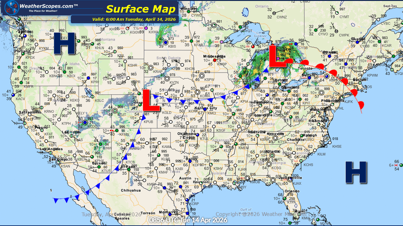
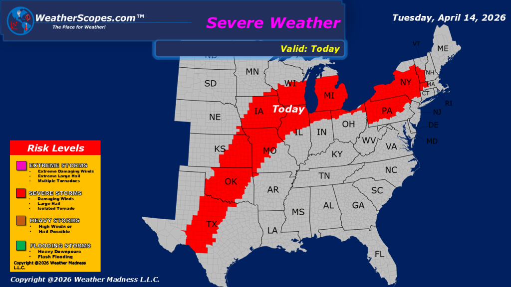
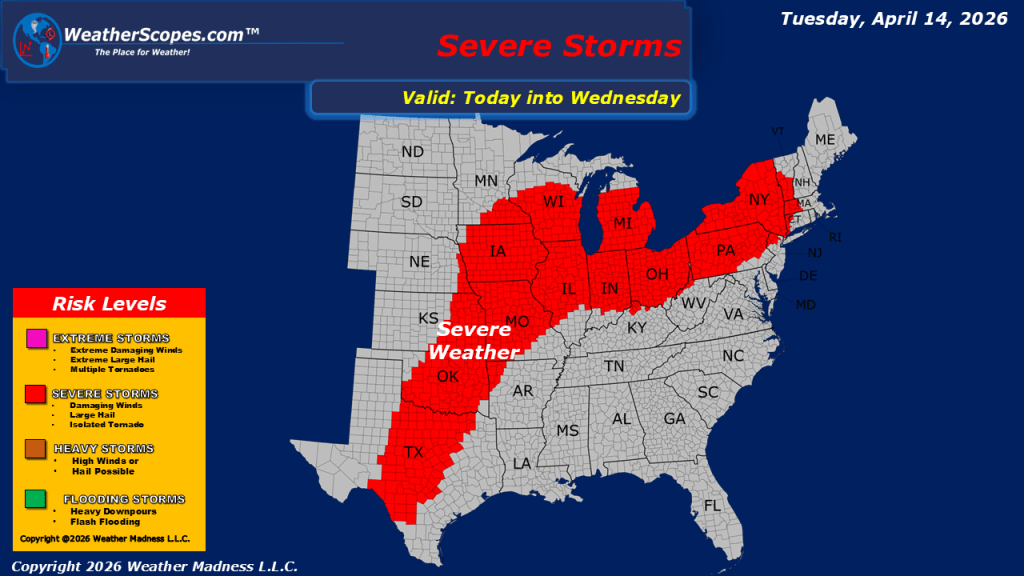
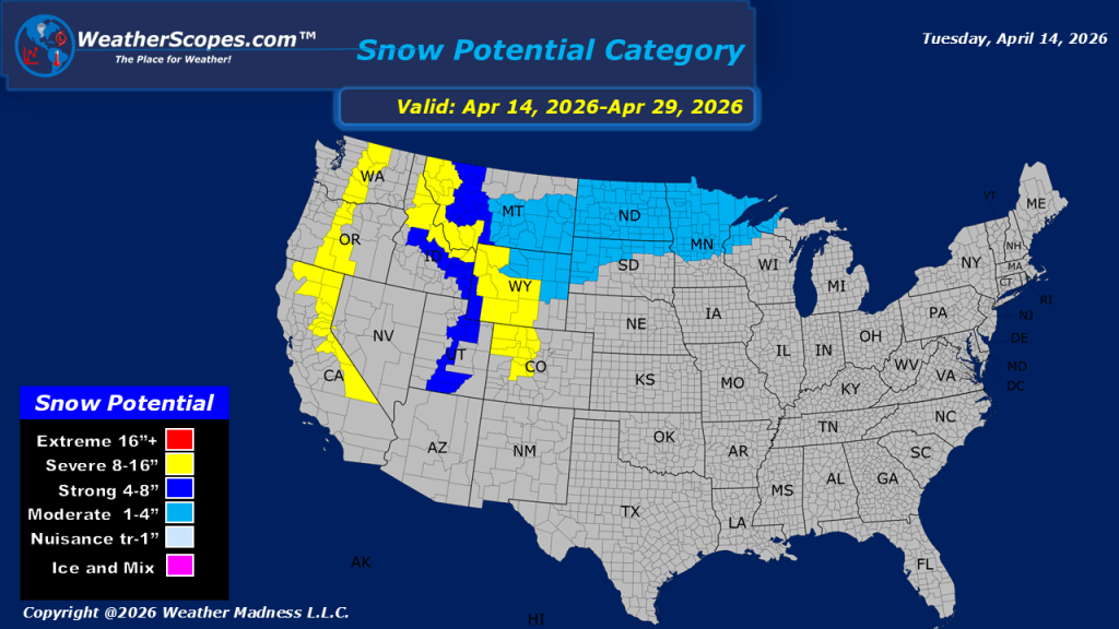
This morning, showers and thunderstorms are currently moving through portions of the Midwest and Ohio Valley, with these storms to continue tracking eastward into the Northeast throughout the day. As these storms progress, some may become severe, bringing the potential for strong winds, heavy rainfall, and isolated severe impacts. Attention then turns back to the central United States, where additional rounds of severe weather are expected to develop later today and continue into tonight. These storms will impact the Midwest through the Plains and into Texas. The environment supports an all-hazards severe weather threat, including damaging winds, large hail, and the potential for tornadoes, as this ongoing outbreak continues to evolve. With repeated rounds of rainfall expected, there is also an increasing potential for localized flooding in some of these areas. Yesterday alone saw nearly 250 reports of severe weather, including multiple tornado reports, underscoring the intensity of the current pattern. A persistent flow of warm, moist air from the south continues to fuel these systems, providing the necessary ingredients for repeated rounds of storm development. Meanwhile, conditions across the western United States remain markedly different. Cooler and wetter weather is in place, particularly across the Pacific Northwest, where showers will persist throughout the day. In the higher elevations of the Rockies, snowfall is expected, contributing to the unsettled conditions across the region.


Leave a comment