
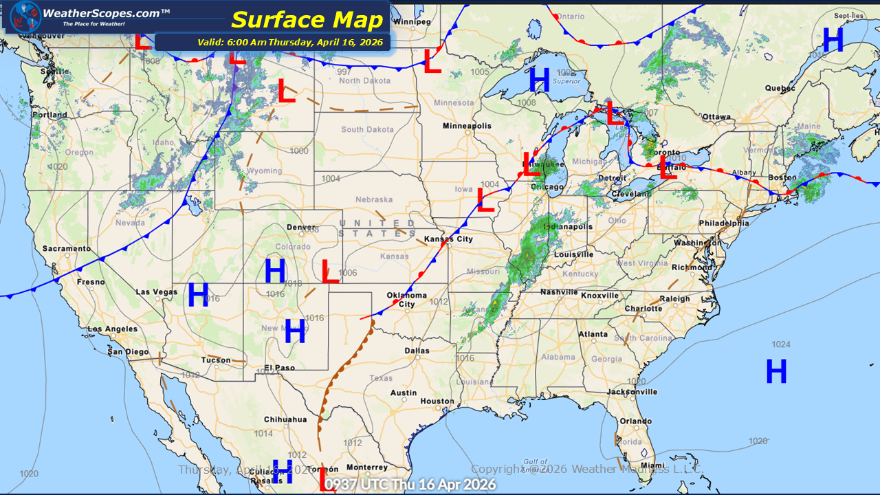
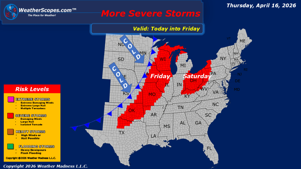
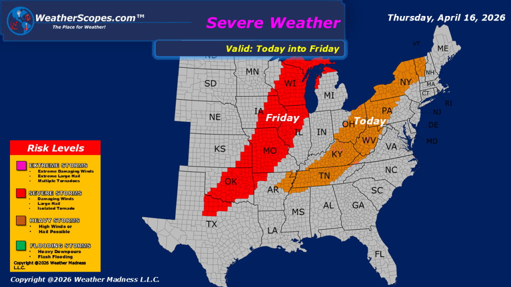
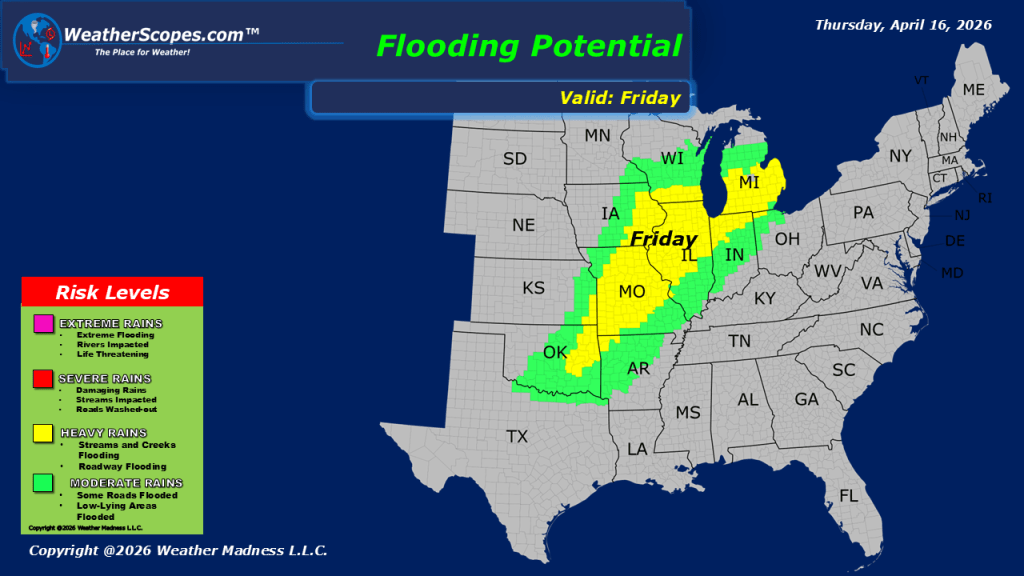
This morning, showers are moving through the Upper Great Lakes and extending into the Ohio Valley and Northeast. Out West, colder conditions are supporting snowfall in the higher elevations of the Rockies. As the day progresses, the potential for gusty thunderstorms will increase across a broad region, stretching from portions of the Mississippi Valley into the Tennessee and Ohio Valleys and further into the Northeast. Some of these storms may produce strong wind gusts, and areas in the upper Mississippi Valley and central New York, Vermont, and New Hampshire could also see hail with the more robust activity. Temperatures across the central and eastern United States remain mild to warm, contributing to the unstable conditions driving today’s storm development. In contrast, the western United States continues to experience cooler and wetter conditions under a more unsettled pattern. Looking ahead, a shift in the pattern is expected as cooler air begins to move into the eastern portion of the country this weekend and into early next week. With this change on the horizon, the current stretch of warmer weather will be short-lived.

Leave a comment