
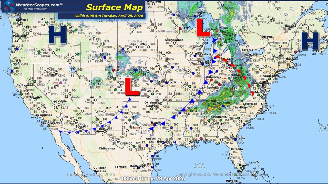
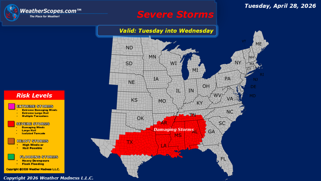
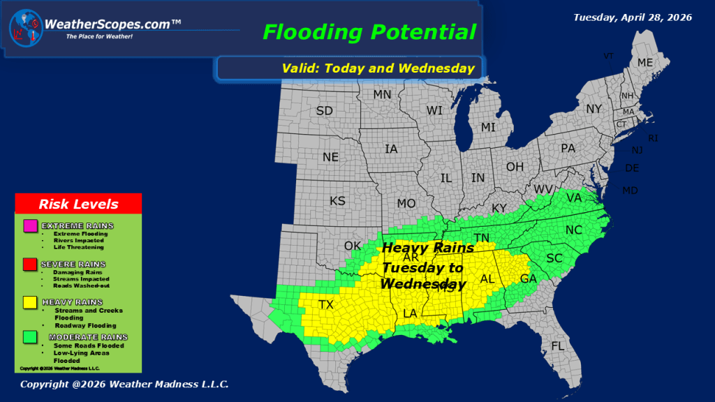
This morning, showers and thunderstorms are extending from the Northeast through the Mid-Atlantic and into the Southeast. Farther west, northern Texas is experiencing isolated thunderstorms, some of which have already reached severe levels, prompting warnings as they move through the region. Additional rainfall is also developing across parts of the Plains, contributing to an already active start to the day. As we move into the afternoon and evening hours, conditions are expected to remain conducive for severe weather, particularly across the Mississippi Valley and into the Southeast. All hazards are in play with these storms, including damaging winds, large hail, and the potential for tornadoes. Residents in these areas should remain alert and prepared for rapidly changing conditions. Localized flooding with also be a concern with these storms bringing some heavy rainfall. Beyond the storms, a broad swath of the country will contend with gusty winds today. The Plains, Great Lakes, and Ohio Valley are likely to experience winds with gusts reaching around 40 miles per hour, which could impact travel and outdoor activities. Temperature-wise, much of the US will enjoy relatively mild conditions. However, cooler air will persist across the Pacific Northwest, northern Plains, Great Lakes, and parts of the Northeast, providing a contrast to the otherwise moderate springtime temperatures elsewhere.

Leave a comment