
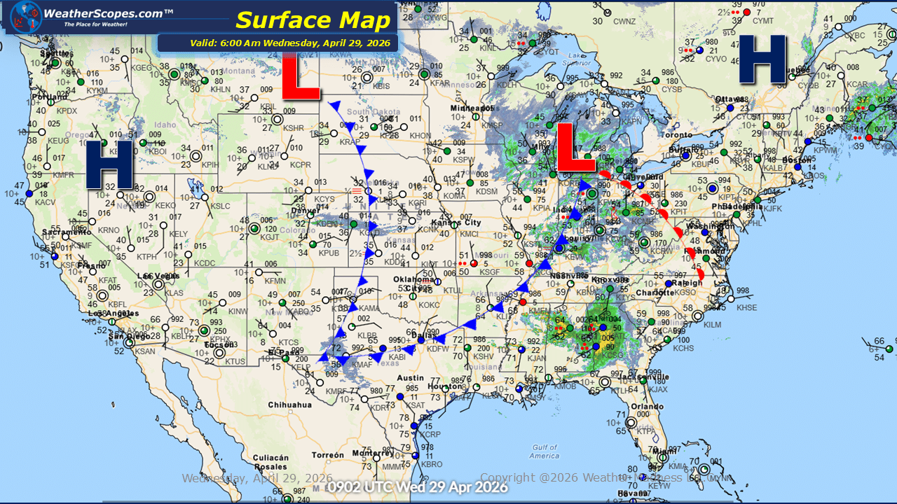
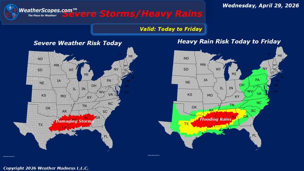
This morning, showers are moving across the Great Lakes and extending into portions of the Ohio and Tennessee Valleys, setting the stage for another active weather day across parts of the country. This system is part of a broader pattern that continues to support unsettled conditions, particularly farther south. Attention turns to the lower Mississippi Valley, Eastern Texas and the Southeast, where a renewed threat of severe weather is expected to develop. Storms in this region may bring heavy rainfall, strong wind gusts, and hail. Atmospheric conditions are also supportive of isolated tornado development, meaning a brief tornado or two cannot be ruled out as these storms evolve through the day. Elsewhere, breezy conditions are expected to impact several regions. The Southwest and northern Plains will experience gusty winds, while a corridor from the Ohio Valley into the Northeast could see wind gusts reaching around 30 to 35 miles per hour. These winds, while not extreme, may still contribute to minor travel disruptions and elevated fire weather concerns in drier areas. Temperature-wise, much of the United States is experiencing relatively mild conditions for this time of year. Cooler air remains in place across the northern Great Lakes and persists in higher elevations out West.

Leave a comment