
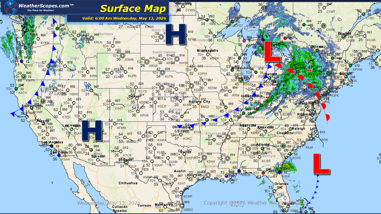
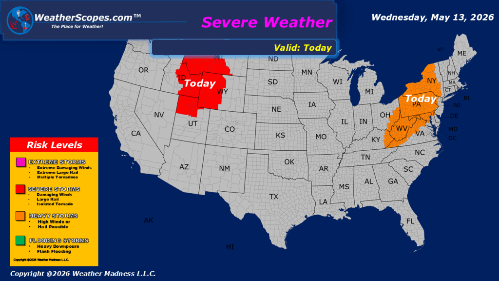
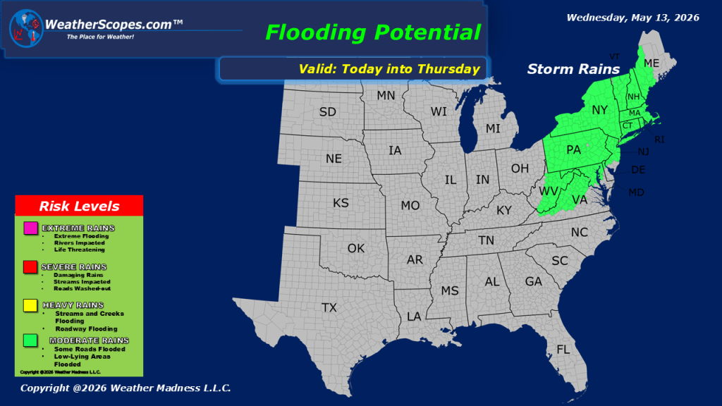
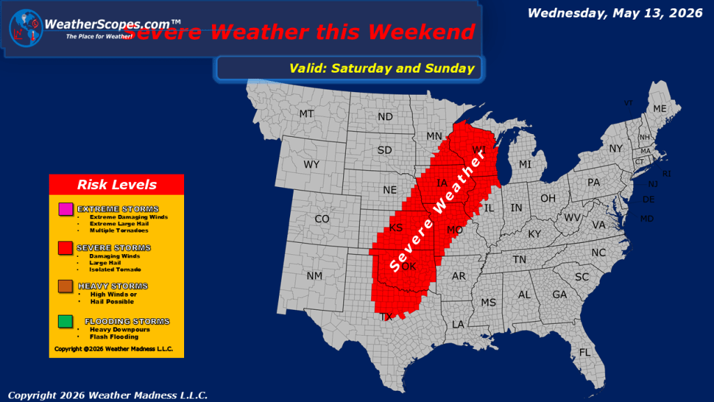
this morning, we are seeing showers moving across the Northeast and extending southward into the Appalachians. These areas, along with portions of the Tennessee Valley and Mid-Atlantic, could see gusty thunderstorms develop today. Some of these storms will produce heavy rainfall, leading to the potential for localized flooding in areas that experience repeated downpours. Out west, portions of the Pacific NW and areas across Montana, Idaho, and Wyoming could see severe weather develop later today. Gusty conditions will once again impact much of the Midwest into the Ohio Valley and Northeast, where wind gusts around 30 mph are expected. Stronger winds are likely across the western United States, with gusts over 40 mph possible from the Pacific Northwest and Montana southward into Utah and northern Arizona. Mild temperatures continue across much of the country, although cooler conditions remain across the Pacific Northwest and portions of the Northeast. Meanwhile, the Desert Southwest into western Texas could see temperatures climbing near 100 degrees today. Looking ahead to the weekend, another round of severe weather could develop from Wisconsin southward through the Plains and into Texas as a more active storm pattern begins to take shape across the central United States.

Leave a comment