
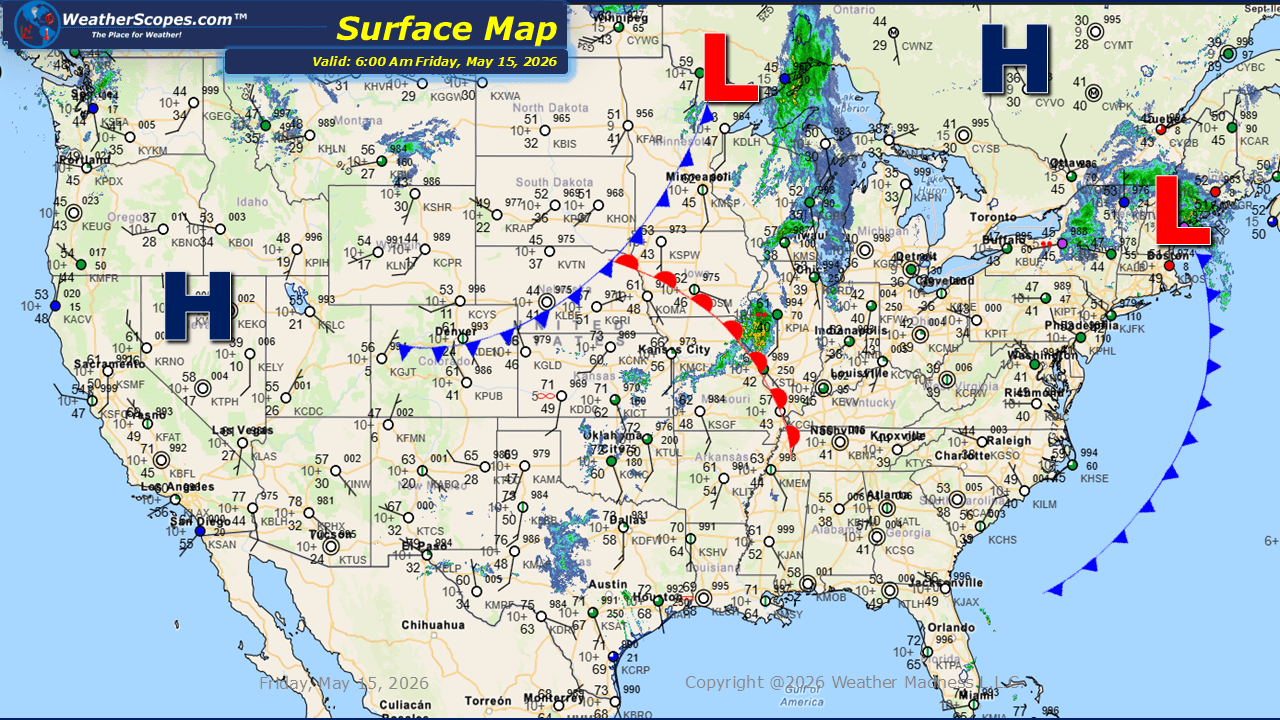
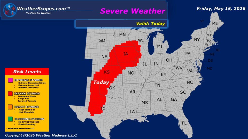
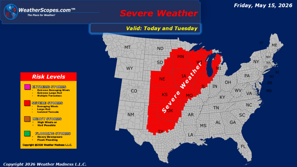
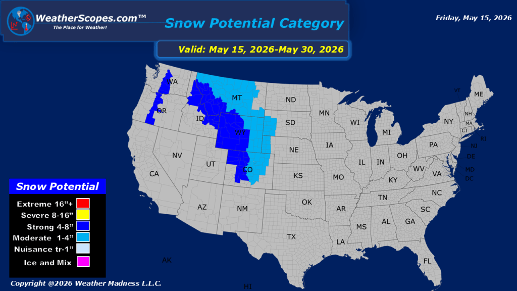
This morning, we are seeing showers moving across portions of the Midwest, New Hampshire into Vermont, and parts of the Pacific Northwest. Later today and into the overnight hours severe weather is expected to develop from the Midwest through the Plains and into Texas. These storms could produce heavy rainfall, hail, and strong wind gusts as another round of active weather unfolds across the central United States. This setup begins what looks to be a prolonged stretch of daily severe weather chances over the next several days. Gusty conditions are also expected today across much of Montana into the Northern Plains and Great Lakes regions, with wind gusts around 40mph. Warm temperatures continue across much of the central and southern United States, including the Desert Southwest, while cooler air remains across portions of the Pacific Northwest and Northeast. Looking ahead to the weekend, more rounds of thunderstorms are expected to develop across the Plains and Midwest. By Sunday into Monday, colder air moving into the Northern Rockies could bring accumulating snow, and the Denver metro area may once again see snowfall during the month of May.

Leave a comment