
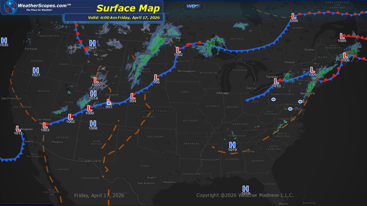
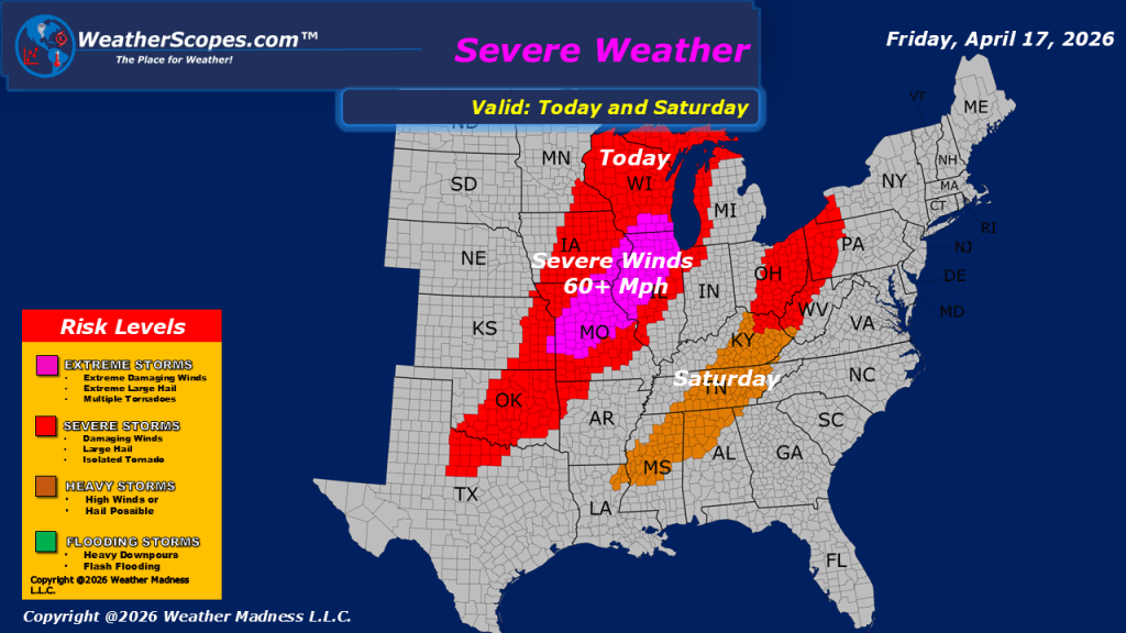
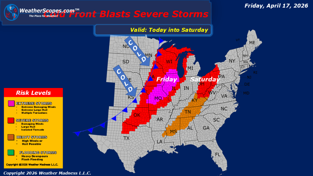
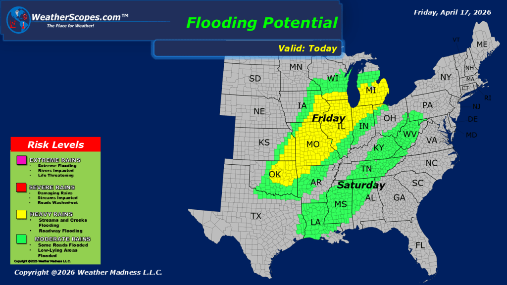
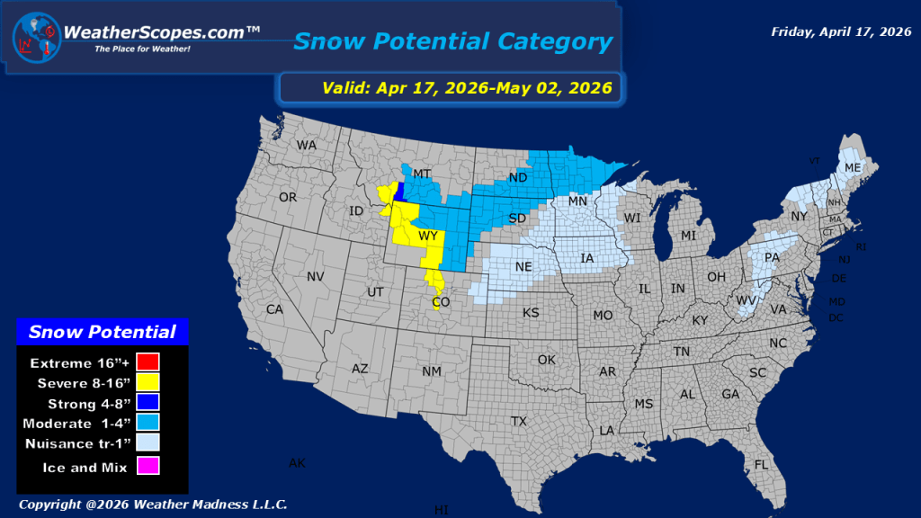
This morning, snow is falling across the Dakotas, where some locations may see a light coating, while northern areas of North Dakota could receive 3 to 4 inches. Farther east, isolated thunderstorms are moving through the Minneapolis–St. Paul area, and lingering rain continues across parts of the Northeast. As the day progresses, the Midwest will once again be a focal point for severe weather. Storms are expected to develop from the Midwest into the Plains during the afternoon, continuing into the evening and overnight hours. The environment will support an all-hazards threat, including damaging winds, large hail, and the potential for tornadoes. In addition, repeated rounds of rainfall across the Midwest may lead to localized flooding concerns. In the wake of this system, a strong cold front will push through, ushering in a much colder air mass across the Northern Plains, Great Lakes, and Northeast. This shift will be noticeable over the weekend and into early next week, with some areas potentially experiencing morning temperatures dropping into the 20s over the next several days.

Leave a comment