
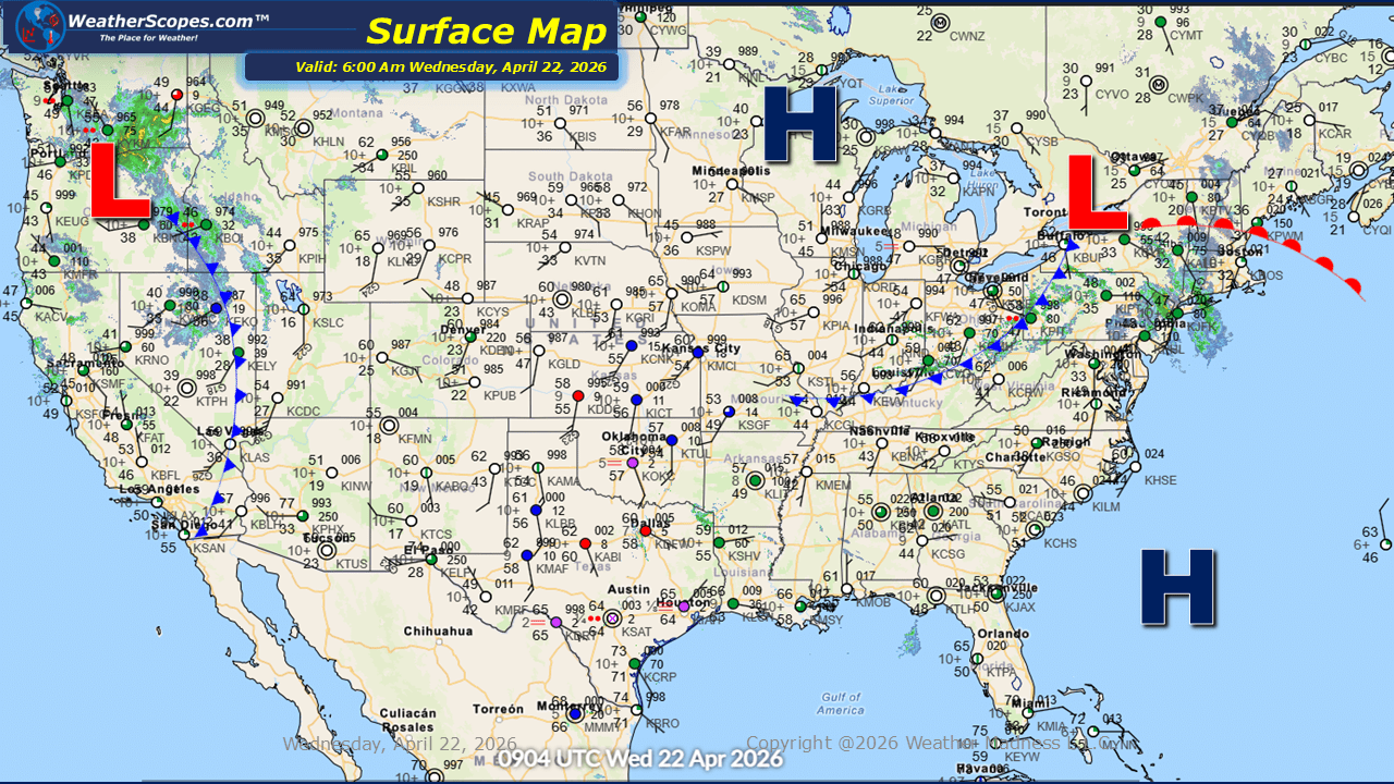
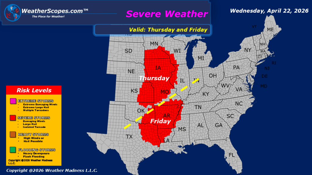
This morning, showers are moving through parts of the Northeast and Ohio Valley, while additional storm activity is ongoing across the Pacific Northwest and California. Showers are impacting portions of the lower Mississippi Valley, and an isolated thunderstorm is moving through parts of Iowa. In the Rockies and Sierras, the system bringing rain to the area will also produce snowfall in the higher terrain. Gusty conditions out west in Wyoming/Idaho, stretching south into portions of Colorado and Utah. Wind gusts could reach 50mph+. As we move into tonight and the overnight hours, additional showers and thunderstorms are expected to develop across the Ohio Valley, with some storms potentially becoming severe. Temperatures remain on the warmer side across much of the United States, while cooler conditions persist out West and in portions of the Northeast. Looking ahead to tomorrow, severe weather is expected to redevelop across the Plains and extend into the Midwest, bringing another round of potentially all-hazards severe storms. We will need to monitor these storms, as they begin to take shape.

Leave a comment