
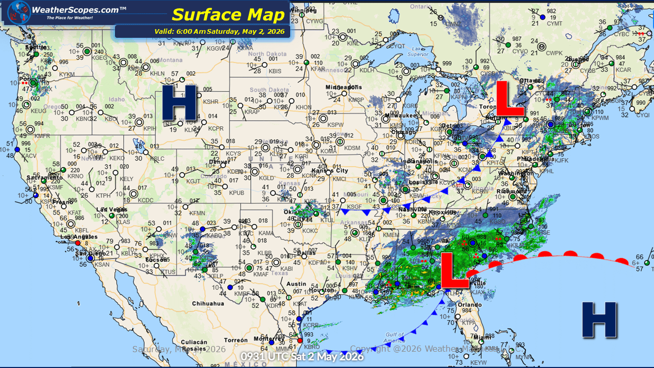
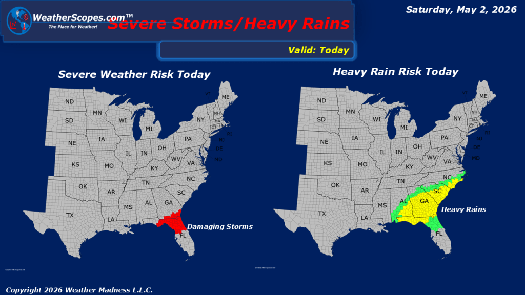
This morning, we are seeing showers and thunderstorms moving through Florida and parts of the Mid-Atlantic. As the system evolves, attention turns to northern Florida, where atmospheric conditions may support the development of stronger storms later today. Some of these could become severe, with the potential for gusty winds, heavy rainfall, and localized flooding. Showers are also coming through the Ohio and Tennessee Valley’s this morning, The Great Lakes and Northeast continue to experience the lingering effects of a cooler air mass. Morning temperatures in these areas have dipped low enough to prompt frost warnings in some locations, a reminder that early spring conditions can still bring sharp temperature swings. This pattern is expected to continue over the next few days, with periods of mild temperatures followed by another return to cooler conditions across the region.

Leave a comment