
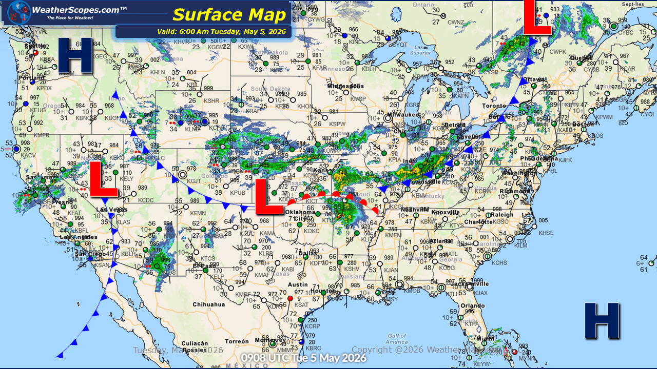
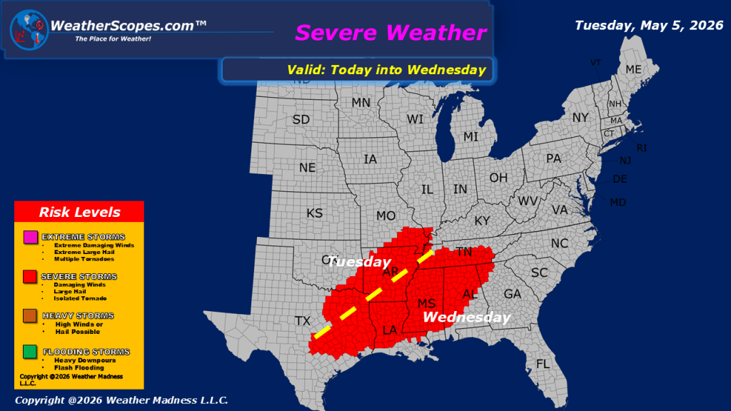
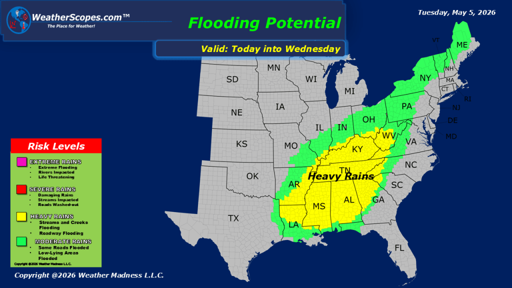
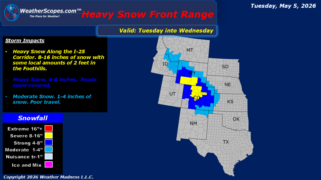
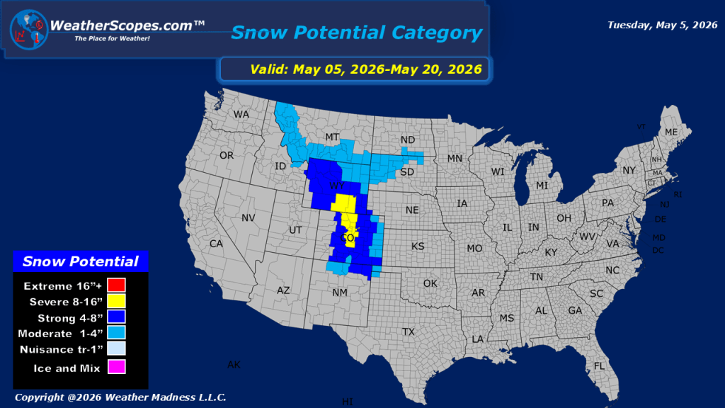
This morning, showers and thunderstorms are moving across the Plains into the Midwest and Great Lakes, extending into the Mississippi Valley. Additional severe weather is expected to develop today and continue into tonight and the overnight hours across the Mississippi Valley, with heavy rainfall, hail, and damaging winds. With repeated rounds of precipitation, localized flooding will also be a concern in these areas. It will be another windy day across much of the Northeast, Mid-Atlantic, the Mississippi Valley, and parts of western Texas into the Four Corners region. Meanwhile, a strong system will bring accumulating snowfall to the Rockies and Front Range, including the Denver metro area, tonight into Wednesday morning, where totals could exceed 6 inches. The broader pattern remains cool and wet across much of the eastern United States, as cooler air from Canada continues to interact with warm, moisture-rich air from the Gulf, supporting ongoing rounds of precipitation and unsettled conditions.

Leave a comment