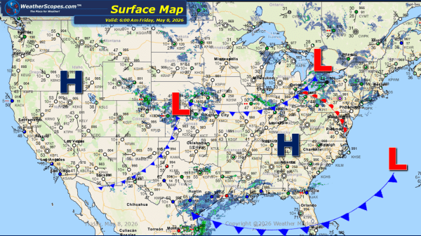
Daily Maps Friday April 17th, 2026

This morning, snow is falling across the Dakotas, where some locations may see a light coating, while northern areas of North Dakota could receive 3 to 4 inches. Farther east, isolated thunderstorms are moving through the Minneapolis–St. Paul area, and lingering rain continues across parts of the Northeast. As the day progresses, the Midwest will... Continue Reading →

Daily Maps Thursday April 16th, 2026

This morning, showers are moving through the Upper Great Lakes and extending into the Ohio Valley and Northeast. Out West, colder conditions are supporting snowfall in the higher elevations of the Rockies. As the day progresses, the potential for gusty thunderstorms will increase across a broad region, stretching from portions of the Mississippi Valley into... Continue Reading →

Daily Maps Tuesday April 14th, 2026

This morning, showers and thunderstorms are currently moving through portions of the Midwest and Ohio Valley, with these storms to continue tracking eastward into the Northeast throughout the day. As these storms progress, some may become severe, bringing the potential for strong winds, heavy rainfall, and isolated severe impacts. Attention then turns back to the... Continue Reading →

Weekly Highlights April 13th to 18th

This week’s weather pattern across the United States is shaping up to be active and, at times, hazardous, with multiple regions experiencing a variety of impactful conditions. Severe weather is expected to break out across Minnesota and into northern Wisconsin on Monday. Heavy rainfall, large hail, and gusty winds will be possible throughout the day.... Continue Reading →

Website Powered by WordPress.com.

Up ↑